Google Maps road names: the official record has no way in
On Google Maps, my road shows under three spellings across four blocks. The county has the right name. The map has no way to take it.
The story in three parts
A wrong name that spreads
A rural road on Hawaiʻi Island changes spelling block by block on the map. Sites that check addresses against map data reject or rewrite the address, so the error reaches deliveries and account forms.
Proof in, reasons out
Let residents attach proof, match it against official records, and tell them why an edit was rejected and when an accepted one will show up.
Accepted, still wrong
Two corrections were accepted on October 10, 2026, with a stated 24 hour update. On October 17 the map still showed both wrong names.
What the work turned up
The record is public; nothing connects it
The county sends approved street names to emergency services, the post office and the utility, and anyone can look them up on its public web map. It does not send them to Google, and says it has never been asked.
A status, but no reason
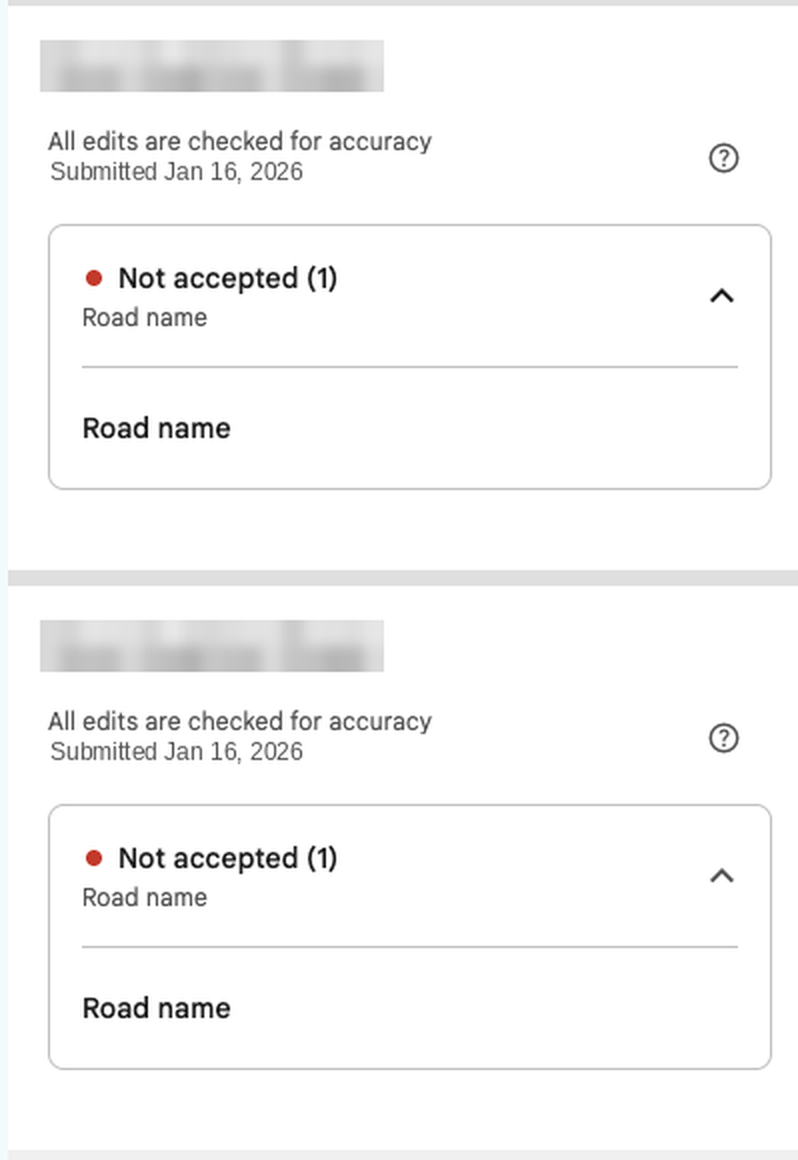
Rejected edits show "Not accepted" and nothing else: no reason, and no way to add evidence or appeal.
Accepted is not the same as fixed
The acceptance email never says what changed, and the promised 24 hour update did not arrive in a week.
The problem
Residents who hold the official record of their road's name have no way to hand it to the map.
The road I live on is one straight road. On the map, its first and last blocks carry the correct name and the two blocks between them carry two different misspellings. A second road in the same neighborhood has the same kind of error. Both drop a syllable from a Hawaiian name, which points to a bad source dataset rather than a one-off typo.
The cost is downstream. Many sites check an address against map data, so a wrong name turns into rejected addresses and addresses "corrected" to the wrong street on delivery, sign-up and verification forms.
The only channel a household has is the public edit form. A business can manage its own listing; a home cannot. One homeowner in a public thread got their house onto the map only by creating a business listing for it, which is the honest path failing and the data getting worse as a result.
Road names, the town, map screenshots and county documents are left out of this page on purpose. The details are real; they identify where I live.
This is an independent case study of a product I use. I am not affiliated with Google, and nothing here reflects how Google works internally beyond what any user can see.
The evidence
Three correction attempts over 29 months, each one dated, and the county's answers.
| Date | What happened |
|---|---|
| Oct 19, 2026 | The county answers a follow-up: its official street names are published on a public web map, and residents raise this kind of problem with it roughly 3 to 4 times a year. |
| Oct 17, 2026 | Both corrected blocks still show the wrong names, 7 days after acceptance. The second road's first-ever correction is still pending after 8 days. |
| Oct 14, 2026 | The county replies: it does not send street names to the map and has never been contacted about its data. Other residents have reported the same problem. |
| Oct 10, 2026 | Both edits accepted by email, 37 minutes apart. Each says edits may take 24 hours to appear. Neither says what the road will be called. |
| Oct 8, 2026 | Third correction, one edit per wrong block. Same day: a public help forum post and an email to the county planning department. |
| Jan 16, 2026 | Second correction, one edit per wrong block. Both marked "Not accepted," with no reason and no way to add evidence. |
| May 28, 2024 | First correction. No change on the map. |
The one reply on the forum post, from another user, confirmed there is no official way to attach documents to a road-name correction. Elsewhere, an Irish county council asked for a misnamed road to be fixed and was still waiting almost two years after it was first raised. Official channels for government map data exist, but they are for approved organizations, not residents.
The county also believes corrections need many reports before they are acted on, and its suggested fallback is crowd-sourcing. That is its understanding, not a confirmed policy, and this page treats it that way. The steps it forwarded are Google's help for fixing a wrong address or pin, a different flow from renaming a road: even the office that holds the record has no better path to offer.
The journey, today and proposed
Today the journey breaks three times: at submission, at the decision, and after acceptance.
The proposal
Lead with proof, because reasons and status only matter once a correction can be judged on evidence.
- Who it is for. Residents first. A direct channel for county data is the larger fix and a later step; it needs agreements, not a form.
- What counts as proof. An uploaded document, a link to an official source, or a photo of the street sign. Official sources weigh most, and a link is preferred over an upload, because county records can carry personal details.
- Who checks it. An automatic match against official records first (here, the county already publishes its street names on a public web map), and a staff reviewer when no official record exists, so rural roads without public data are not left out.
- What the resident sees. Both a plain reason when an edit is rejected and a tracker that states the new name and when the map will show it. The evidence shows each of these failing on its own.
How I would test it
Ship only if more correct edits are accepted and bad edits do not rise.
- Who gets it. Road-name corrections in a few rural counties, split half and half between today's flow and the new one.
- Success. More correct edits accepted, with fewer repeat submissions as a supporting measure.
- Guardrail. Bad or fake edits getting through. Easier acceptance is exactly what a vandal would look for, so this is the number that can stop the launch.
- Ship rule. Correct acceptances go up and bad edits do not. A fix that lets in more vandalism is not a win.
Where AI should not be used
AI can match uploaded proof against records and flag patterns, such as names that lose a syllable the same way across a neighborhood. It should never rename a road on its own. A confident wrong rename is the failure this case study documents, so a rename needs an official record or a person.
Where it stands
- As of October 17, 2026: both corrected blocks were accepted on October 10 and still show the wrong names.
- The second road's first-ever correction, submitted October 9, is still pending.
- As of October 19, 2026, the county has answered both of my questions. Its official street names are on a public web map, and residents raise this problem with it roughly 3 to 4 times a year.
- This is a proposal. Nothing here is built, and no part of it has been tested with users beyond my own attempts.